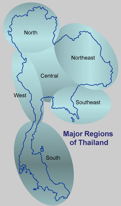
Thailand can be broken up conveniently into six major geo-biological regions, each with its own fairly distinctive character and natural history. Some areas, such as north and central Thailand, have been well explored orithologically and much is known of their natural history. Others such as the northeast have been poorly covered. Links provided to a sharable Google Map and/or Google Earth map for localities and places throughout Thailand, and maintained by North Thailand Birding.
|
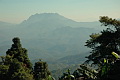
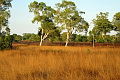
Major Regions of ThailandNorth Thailand. Characterised by a largely Himalayan fauna and flora, wtih many high mountains, including Doi Inthanon - the highest point in Thailand. Northeast Thailand. The dryest area of Thailand. Very developed agriculturally. Characterised by dry forests and hot dry plains. Some mid elevation rainforest remains in the south and northwestern parts of this area. Central Thailand. Low-lying plains and extensive agriculture. A small number of important wetland areas remain. West Thailand. A range of forests with increasing rainfall moving southward. Despite some extensively forested areas, difficulty of access, particularly along the border, has left much of this area rather unexplored. Southeast Thailand. Forests along the eastern edge share some of the unique biodiversity of the Cardamom Mountains stretching into Cambodia. South Thailand. The far south shares an avifauna with the majority of the Malay Peninsula and is the only place in Thailand where a fair number of these southern specialities can be found. Some important forests are found dotted along the length of the Thai peninsula. Large areas of mangrove can still be found. Offshore are some important coral islands. Provinces of Thailand by RegionThe six major regions are currently comprised of a total of 76 provinces. A map of these provinces may be found here. The provinces within each region used on this site, together with their Thai names, are: |
North Thailand Chiang Mai - เชียงใหม่ |
Northeast Thailand Amnat Charoen - อำนาจเจริญ |
West Thailand Kanchanaburi - กาญจนบุรี Note that although Nakhon Sawan geographically sits mainly in central Thailand, biologically it spans both west and central Thailand when considering the forest type of the western mountains. |
Central Thailand Ang Thong - อ่างทอง |
Southeast Thailand Chachoengsao - ฉะเชิงเทรา
|
South Thailand Chumphon - ชุมพร |