
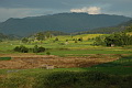
Natural habitat in the region is dominated by two forest types; evergreen rain and dry Dipterocarp. This is by far the most mountainous of Thailand's major regions, with a characteristically Himalayan fauna and flora. Large areas rise to over 1,000 metres with all of Thailand's 2,000 metre plus peaks found here, including the highest point; the 2,565 metre summit of Doi Inthanon. The list of important birding sites of this region is dominated by mountain parks, which are excellent for both residents and wintering migrants. Winter birding is best when harsh weather conditions across China force migrants to move southward. Ornithologically interesting river systems include the Mekong and Mae Kok Rivers in the far north. The large lake and surrounding wetlands at Chiang Saen in the northeast is the only major waterbird area of the region. Links provided to a sharable Google Map and/or Google Earth map for localities and places throughout Thailand, and maintained by North Thailand Birding.
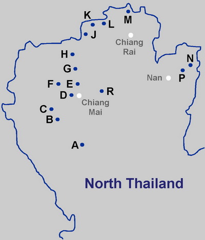 |
D. Doi Suthep-Pui National Park F. Queen Sirikit Botanical Garden G. Mae Taeng Irrigation Project H. Chiang Dao and Doi Chiang Dao K. Doi Lang L. Thaton M. Chiang Saen |