Overview
The ornithological claim to fame of Ob Luang National Park, is a record of Brown Dipper from some years previously. One look at the habitat is enough to suggest this bird is likely to reappear during some future cool season. Information on this page verified/accurate as of 22 June 2012.
|
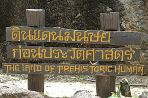
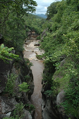
The park occupies an area of 553 square kilometres, around 80 kilometres south of Chiang Mai, and joins to the southern edge of Doi Inthanon National Park. Altitude varies from 200 to 1,656 metres, with the most accessible areas around the park headquarters at around 350 - 500 metres. Habitat here is primarily deciduous Dipterocarp forest, with some gallery forest along the river. With only limited habitat accessible, a large bird list is unlikely, but in addition to the possibility of the dipper in winter, a number of interesting birds might be found. Like many smaller, less known, parks, Ob Luang is rarely visited by birders and under-watched. The park is mostly known for its impressive Ob Luang Gorge - a narrow precipice through which, in the wet season, the river thunders. A footbridge over the narrowest section of the gorge provides good photo opportunities. The area is also an important archeological site, with prehistoric cave paintings, and bronze age burial sites among other items of interest, viewable along the Prehistoric Nature Trail. |
Access
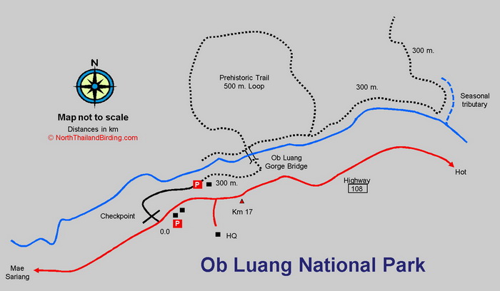
From Chiang Mai, head south from town on Highway 108 for 85 kilometres, passing the Doi Inthanon turnoff, to the small town of Hot. In the centre of town turn right, sign posted for Mae Sariang and Mae Hong Son, and zero the trip meter. This is still Highway 108, and after 17.2 kilometres the park entrance is found on the right hand side.
Accommodation and Facilities
The park has a couple of bungalows as well as a camp site, from which tents should be available for rent. There is also a restaurant and a couple of food kiosks along the road by the entrance checkpoint. It would probably be unwise to expect these facilities to be open after dark. Resort accommodation is available around the town of Hot, as well as slightly farther north at Chom Thong and along the road to Doi Inthanon.
Birding
Checkpoint and River area.
Once through the park checkpoint it's a short walk to the river, which can easily be scanned from the bank, or from the suspended foot bridge over the gorge. Blue Whistling Thrush is common. This section contains many boulders and rocks and is the most likely area that Brown Dipper would occur. Check overhead for Himalayan Swiftlet and Black Baza.
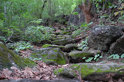
Prehistoric Trail and River Trail
Once over the footbridge it's possible to follow the Prehistoric Trail, which runs for 500 metres and joins the trail along the river on its return. Habitat here is mainly bamboo and dry forest. Common species include Lesser Necklaced Laughingthrush and White-rumped Shama. In the winter some more interesting species should likely include Siberian Blue Robin. Walking westward down the river it's possible to follow a trail for about 300 metres to a point where a season tributary flows in from the left, at which point the trail turns north and can be followed for a few hundred metres uphill. Unfortunately the trail seems to peter out due to lack of use, although as the forest is fairly open it would be possible to continue with the aid of a GPS. Indochinese Blue Flycatcher occurs.
Mae Jon Waterfall Trail at Km 9
Another trail can be found by returning along the main road back toward Hot to the Km 9 marker. The trail is found on the southern side of the road, and runs for about a kilometre to the Mae Jon Waterfall. Species likely here are the same as around the HQ area.
Checklist
Checklist of species.
Gallery
Additional images from Ob Luang available in the Thailand Travel gallery.
Sunrise and Sunset
Detailed sunrise and sunset times.